

Editors’ Note: This blog is another installment in our Project Firehawk series, the series is named in reference to a cohort of Australian birds who carry fire in their beaks to spark change. Its essays explore the core underpinnings of our work, and in some cases, challenge the status quo. We have asked the series’ authors to be bold as they tackle hard questions to reveal needed shifts in our relationship with fire. We have asked them to be unafraid as they point out what is (and isn’t) working in our current system. These thought pieces may challenge you, create controversy, or even cause you to stand up and cheer. Regardless of your reaction, we hope this series causes you to pause and maybe even initiate a larger conversation about what it really means to live better with fire.
This blog, written by Ed Keith, County Forester in Deschutes County, Oregon takes on the concept and practices around the Wildland Urban Interface (WUI).
What’s in a name? How much debate and consternation could three little words used to label an area where there is a combination of development and vegetation cause? Yes, I’m talking about the WUI; rhymes with phooey and otherwise known as the Wildland Urban Interface. If the debates currently raging in Oregon are any indicator…there’s a lot to those three little words.
I’d wager that when you think of the term WUI you think of some of the places you work, live or play that definitely fit the definition. Most of us have a “I know it when I see it” approach to the WUI, but what is that based upon? If I were to ask each reader of this article to draw it for me on the map, we might come up with as many versions of the map as we have map makers. And therein lies the rub.
While I don’t think the three words that make up the term perfectly describe the concept, WUI has been around long enough that wildfire practitioners have a pretty good understanding of what it represents. But then we put that concept in planning documents, codes and ordinances, and even try to map it. And when we start to do that, I get to wishing that we could back off to the nearest ridgeline and torch those three words.
Where did the term WUI come from anyway? Apparently, the term first showed up in Forest Service budget documents in the late 1980’s, although it didn’t start to be widely used until the National Fire Plan was formulated in 2000. The term likely resonated with fire managers because it encompassed an emerging issue—one of human communities expanding into areas where wildfires were occurring and infinitely complicating efforts to suppress those fires.
Since then several official definitions of the WUI have been adopted, all attempting to co-opt the term for their own purpose. The Oregon Department of Forestry recently compiled several of them as they were formulating what WUI definition would be adopted as required by the recently passed Oregon Omnibus Wildfire Bill, SB 762. In the end, Oregon adopted the International WUI Code’s version of the definition.

Dissecting it a bit further, we can ask what is implied by each of the words “Wildland,” “Urban,” and “Interface.” Do these words accurately depict the image it conjures in our heads?
Are the wildlands you are thinking of “wild” in the true sense of the term or maybe it is just that the vegetation is native, fire-prone or fire-adapted? We often think of wild places as those that are untouched by humans, but when you consider the wide reach of fire suppression across our country what place is truly wild? I certainly wouldn’t think that anywhere near human development would be a wildland, could wildland and urban areas ever truly meet?
Urban is defined as being “characteristic of a town or city”, but are we just concerned with areas within a town or a city, or when you think of the WUI do you also think of rural places outside of cities and towns where people live, work and play?
Finally, interface implies there is a point or line where these wildlands and urban areas meet. One starts where the other leaves off. When I think of the so-called WUI, looking across the landscapes I work here in central Oregon, there are no clear lines but rather forests and rangelands so mixed and jumbled together with development that I can’t draw that line or point of interface on a map if I tried. I’d be willing to guess that’s the case for you as well.
You know what isn’t in the term WUI? Fire.** There is nothing about fire or fire risk in those three little words and fire doesn’t even show up when it is further defined, as shown in the summary of definitions above; the concept of the WUI is about the composition of structures and vegetation. Yet, when we think of the WUI, we almost always think about fire risk as if there is a magical line where risk exists on one side and doesn’t exist on the other. As if the millions of embers from the inevitable wildfire are supposed to stop at this magical line.

A house sitting on the edge of a forest. Photo by Ed Keith.
Even our newest version of fire behavior fuel models is all about wildland fuels. When you try to model fire spread through a community the models commonly predict that the fire stops when it reaches the urban areas, that magical line. We tend to ignore our city centers in favor of their edges, yet more than one recent wildfire has demonstrated the ability of fire to reach from rural communities to urban cores without much distinction. We think that the vegetation presents grave risk to communities, or that communities present grave risk to the vegetation, when really it is all fuel that will burn when it meets the requirements of combustion.
The WUI, at its core, was a term meant to describe a perceived problem; now it is used to demarcate a perceived place. A short look at a few examples illustrate the issues with this shift:
- The Sleepy Hollow Fire burned into Wenatchee, Washington in June of 2015, in what might have first appeared as a classic WUI fire, with a wildfire burning up to the edge of the city and igniting nearly 30 homes. As firefighters were busy fighting the fire in the Broadview neighborhood, embers from the burning homes travelled to the downtown core igniting and damaging multiple businesses. Subsequent mapping by the Washington DNR shows that this downtown area is not part of the WUI.
- The Tubbs Fire burned 5,636 structures in and around Santa Rosa, California, and just over 25% of those structures were in an area too densely developed to be considered WUI, and another 4% too sparsely developed to be considered WUI. That’s over 1600 structures lost to a single wildfire that weren’t part of the WUI!
- Closer to home, Deschutes County, Oregon defined a “wildfire hazard zone” that encompasses the entire County in 2003. It was just too difficult to think that an area of the county wasn’t at some level of wildfire risk. Would this zone be so all encompassing today if we tried to define WUI instead of the wildfire hazard zone? We’ll see soon as the State is due to complete the task of mapping said WUI by June of 2022.
What is in a name, indeed? At its outset, WUI was used to describe an emerging issue. Now some are more focused on deciding who is in or out of it. And what is implied by being in or out of a WUI? If you are not located within the WUI the implication I get is you don’t have to worry much about wildfire, but that may send a dangerous message, and is leading us away from using an inclusive approach that is needed for communities to begin to live with fire.
When I really start to think about it, using the term WUI oversimplifies the landscape it tries to represent, with all its complex social, political, economic and environmental issues overlaid on an ever changing geography. It implies there are areas in our communities without any risk, it allows us (from residents to decision-makers) to point the finger of blame and transmission at “others” or those who live somewhere else, and our obsession over mapping it perfectly keeps us from dealing with the real issues of adaptation and resilience our communities face.
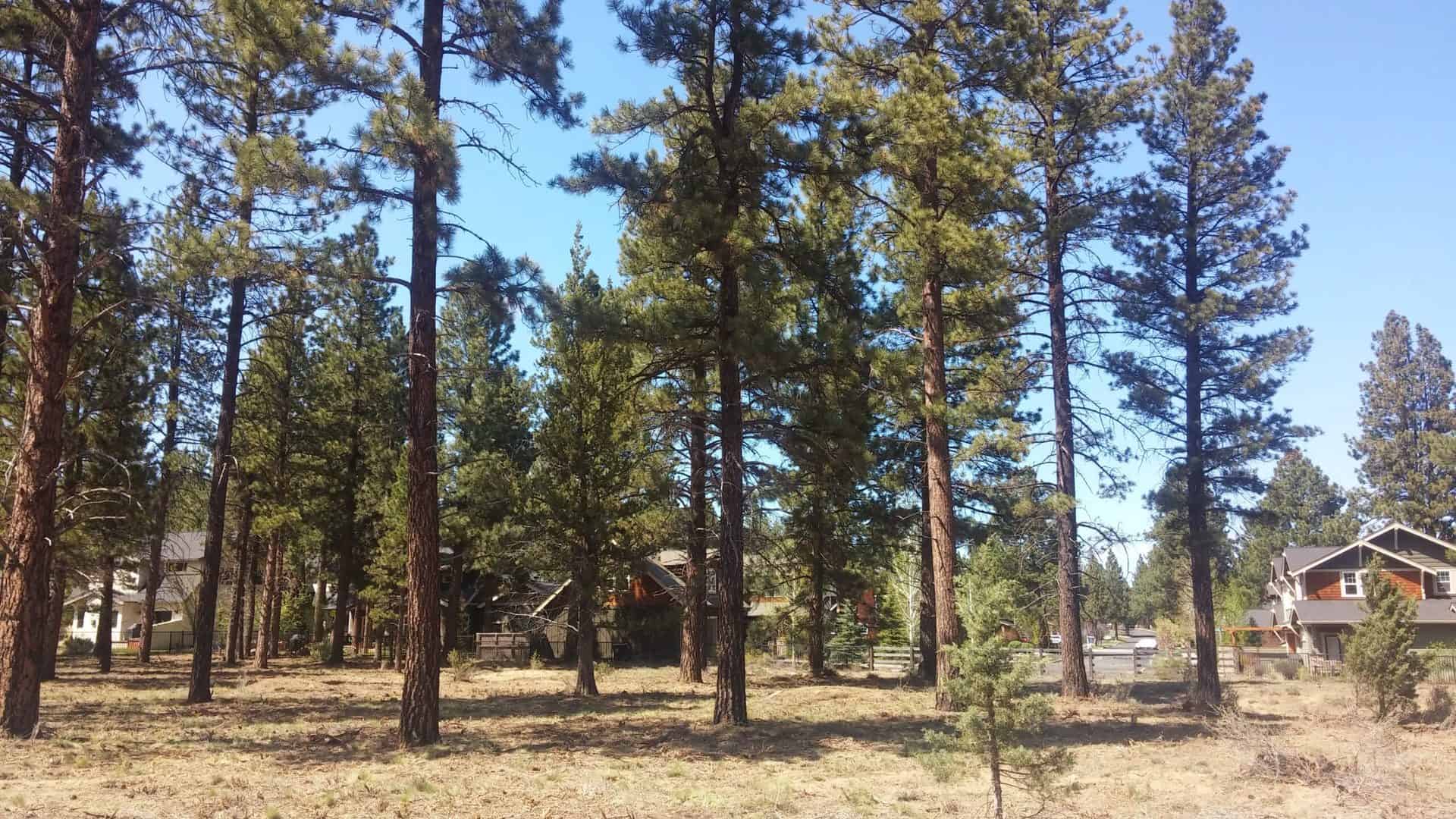
Houses sit within forest vegetation. Photo by Ed Keith.
I submit that it is time to sweep the term WUI to the curb, admit that the issues we’re trying to solve are more complex than something that can be captured in three words, and get back to work restoring our forests and rangelands, improving our wildfire response and continually adapting our communities to the fire adapted ecosystems we are all living in. The WUI is dead. Long live the WUI.
**Read Sarah McCaffrey’s blog on Fire Narratives for more discussion of the term WUI.
* * * *
Great article, Ed. Appreciate your insight on the WUI.
Great article, thank-you for putting this together – your points are incredibly valid and I think the Healthy Forest Restoration Act is probably partly to blame for both the terms widespread use as well as it’s “misuse”. What I love about the definition provided in HFRA is that it allows communities to define their WUI as they see fit – that can be based on the intersection of homes and fuels or it could reflect that their livelihoods such as timber and forage are more important to them and therefore “deserve” the “WUI” designation. At the same time, that’s precisely why we have such a difficult time working through conversations around WUI – as you’ve indicated the numerous definitions don’t point us to the importance of the place but very often we use that dataset and word to reflect our top priority.
For reference, here’s the WUI definition from the Healthy Forest Restoration Act:
The term “wildland-urban interface” means—
An area within or adjacent to an at-risk community that is identified in recommendations to the Secretary in a community wildfire protection plan; or
In the case of any area for which a community wildfire protection plan is not in effect—
->An area extending ½-mile from the boundary of an at-risk community;
->An area within 1½ miles of the boundary of an at-risk community, including any land that:
–> has a sustained steep slope that creates the potential for wildfire behavior endangering the at-risk
community;
–> has a geographic feature that aids in creating an effective fire break, such as a road or ridge top; or
–> is in condition class 3, as documented by the Secretary in the project-specific environmental analysis; and
->An area that is adjacent to an evacuation route for an at-risk community that the Secretary determines, in
cooperation with the at-risk community, requires hazardous fuel reduction to provide safer evacuation from
the at-risk community.
Kristy, thanks for this thoughtful comment. Yes, I think IF the WUI was used for one purpose in one context, such as what was intended with HFRA, I could entertain the idea it could possibly be mapped. And yet, when we start to use it in CWPP’s for the intention behind HFRA we come up with one map, when we use it to consider where codes and regulations should apply we come up with another, and when we use it to determine funding priorities it is yet another map. That’s when I start to think it is a less than useful term, especially if people that could be impacted by fire are left out of the conversation.
I think we should move to Wildland Residential Interface (WRI) for some of the reasons you describe. Plus, we can pronounce it “WORRY” which would have more salience ;-).
Thank you for your insight Ed. As a professional in this field, I generally hesitate using the term WUI because of it’s broad nature. The CWS has helped reframe our approach and now we need to externally share this vision you present. We are not in or out of the WUI, and instead we are all living with wildfire and the potential impacts to life, property, infrastructure and the environment.
Nice job Ed! WUI, as a geographical area, certainly muddies the waters and confuses us, and the good people we are trying to serve, and distracts from the real issues of structure ignitability and community resilience. Thanks for putting this thoughtful piece together.
Thank You for opening up the “WUI” to a real discussion that concerns the destruction of “Fire” and the fact there are really no boundaries for a “Fire”. Our H.O.A. believes we will always have the potential for a “Fire” to invade our development, and it is our responsibility to be as best prepared as possible for this event. We will be discussing your article, and your thoughts, and comments at our annual membership meeting. Your comments are well taken.
Dang, I had to read really far to find out what WUI stood for. The entire subject matter to this city dweller. I’m only here because I saw a commercial for adaptivefire.org and curiosity got the best of me!
Good info, lots of content, and very well written .
You are so right. Here in we lost some 2300 structures in the city – mostly from embers.
My current fire district, much to your point, is defined as wui for building code and planning purposes. Fire hazard area is more descriptive even though it is effectively the same.
Thank you for these well taken and presented thoughts. I also much appreciate the WRI suggestion. A few years back, my old colleague Andy Chittick offered Wildland Community Interface, which I thought worked better for our neck of the woods than Urban. Made for a torturous acronym, though. Around here outside of the towns we have very dispersed development patterns, so Urban certainly does not apply there.
Another take is from a relatively recent and eye opening paper by Jack Cohen: https://legacy-assets.eenews.net/open_files/assets/2019/01/08/document_gw_02.pdf. He gets a little wonky on the subject, but a couple of choice quotes include, “Although this community fire destruction is initiated by wildfires, structure ignitions are not determined by geographic location; rather, the fire destruction is determined by the ignition conditions of a structure in relation to its immediate surroundings. Hence, the term wildland-urban (WU) fire is used without “interface,” “intermix,” or other geographic references.”, and, “…the WU fire problem cannot be reliably identified as a geographic location (Davis 1990; Martinuzzi et al. 2015) but rather as a set of conditions related to the potential for extreme wildfire behavior and the home ignition potential of an exposed residential area.”
!!!! Right? !!!!!
I am going to bring this idea forward and see what I can do with it. Thanks Ed. Great article!
Ed,
I really appreciate you challenging the “group-think” and making sure that the terms we use. Because, one way to define a profession is a shared culture that shares a common set of terms that help us define, debate, and refine ideas—always for the better. On WUI-I’ve seen the “I” for interface be replaced with intermix-reflecting those areas that aren’t linear but more reflective of pockets of structures that are isolated by high fire-prone areas.
https://www.nrs.fs.fed.us/news/release/wui-interface-intermix